click on the title to see more info
Natural Resources
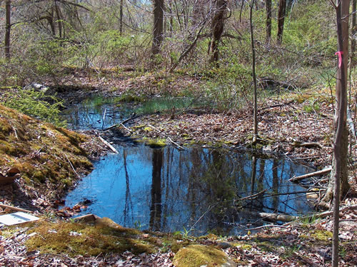
Wetland Delineation
Wetland boundary determinations are often a critical component of land use planning. Delineating wetland boundaries requires a thorough understanding of the existing physical features including topography, vegetation, soils, and hydrologic characteristics. Such delineations also require a mastering of federal, state, and local delineation methodology and criteria.
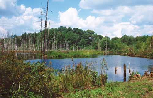
Wetland Functional Assessments
LEC conducts Wetland Functional Assessments to evaluate the qualitative physical characteristics within a wetland, which allows us to determine the functions and values within the ecosystem. Wetland functions and values are inherently linked to understanding site conditions and play an important role in ACOE 404 permitting. This understanding is essential to assessing impacts, project design, potential alternatives, and when necessary, appropriate compensatory mitigating measures.
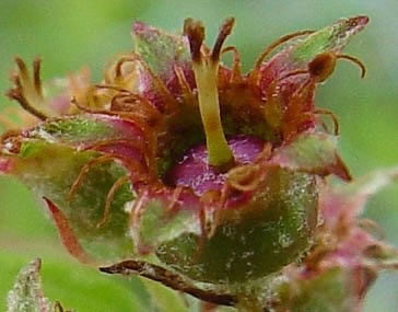
Vernal Pool Identification and Certification
Vernal Pools are ephemeral bodies of fresh water that provide essential breeding habitat for amphibian and invertebrate species, that are often dependent on this habitat for survival. Identification and certification of vernal pools has become an important aspect of wildlife protection and permitting with local, state, and federal agencies.
Natural Resource Management Surveys
LEC conducts Natural Resource Management Surveys to inventory plant community composition, invasive/exotic species, wildlife habitat potential and utilization, and potential rare plant and animal habitats. LEC develops Natural Resource Management Plans that incorporate preservation of critical habitat areas, and often focus on passive recreational use, enhancing wildlife habitat, and/or managing invasive/exotic species. Natural Resource Management Plans are typically prepared for non-profit or public agencies for Open Space management, but may be applied to development projects as part of a comprehensive land management plan.
Rare and Endangered Plant Surveys
LEC conducts a variety of botanical surveys for state-listed rare plants in accordance with NHESP guidelines. As required on all such surveys, NHESP must pre-approve the candidate botanist before the survey begins. Considering LEC's vast botanical survey background, our staff is often pre-approved to conduct such surveys for many state-listed rare plants. Having an understanding of the location(s) and abundance of rare plants on a project site is critical for project design and MESA permitting.
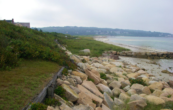
Rivers and Streams
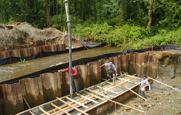
Rivers and Streams provide surficial connections between and within protected wetland systems. Streams are afforded several levels of protection and regulatory criteria at the federal, state, and local levels, depending on their status and function. LEC is well-versed in these often complex regulations, and experienced in working with engineers in order to meet federal and state stream crossing standards. In addition to meeting these standards, preserving long-term stream function through bank stabilization and/or restoration is often required.
Wetland Replication and Restoration
LEC has extensive experience with successful design and implementation of wetland replacement and restoration projects. Successfully restoring or replacing a wetland area is linked to site-appropriate design, qualified oversight during installation, and monitoring and stewardship of the area to maximize success potential. When implemented correctly, a restored/replaced wetland area will serve the same or similar function as the lost area.
Eelgrass Surveys
Eelgrass (Zostera marina) is a submerged flowering plant that is crucial in supporting marine habitats by providing food and shelter for many commercially important species, such as juvenile scallops and flounder. Eelgrass also provides a stabilizing force against physical disturbances of bottom sediments.
LEC provides baseline mapping of eelgrass beds and assessment of population health. This information is used to evaluate potential implications from marine development, design alternatives, and appropriate mitigation when impacts are unavoidable.
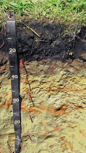
Soil Classification
Soils are primarily differentiated by color, layer, texture, internal structure, firmness, wetness, slope, and landscape position, and classified by examining these characteristics, as they are observed in a soil profile.
For detailed site planning, LEC can make definitive determinations of water table elevation, assessment of hydric soil status on difficult sites and predict infiltration permeability by applying state-of-the-art soil classification methods. A name or class is assigned to a soil having a specific set of characteristics, using national standards. Once a soil is classified in the field, its behavior under various uses can be predicted with regularity. Targeted laboratory analyses may also be performed to strengthen predicted values.
Soil Maps
Soil maps are published in "Soil Survey Reports", providing a general graphic inventory of soils that occur across the landscape, focusing on the upper five feet of surficial material, where most human activity occurs.
While this generalized mapping is a valuable tool, LEC can assist clients with natural resource management, planning, and development by evaluating soils at a much more detailed level. Products such as "High Intensity Soil Maps" and "Site-Specific Soil Maps" can be tailored to specific sites and clients interests.
Some applications for soil mapping include identifying appropriate sites for waste disposal or sources of sand and gravel, predicting water table elevations or infiltration capacity, estimating the depth to bedrock or impermeable layers and determining agricultural potential.